
In the book The Revenge of Geography, Robert D. Kaplan warned us about the error of forgetting the enormous relevance of the physical environment —climate, seas, mountains, etc.— for understanding the evolution of the history of nations and international relations. The same happens in cities. To understand their social dynamics, it is essential to understand how their physical surroundings are configured.
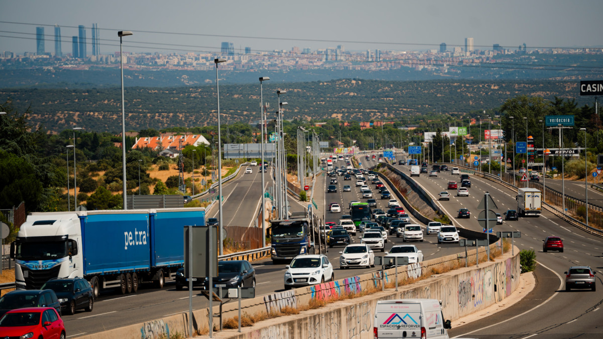
Beyond buildings or public space, there are large physical infrastructures that play highly relevant roles in the city, but which sometimes become internal borders that contribute to the persistence of social inequality. Highways, rail lines, industrial estates and even rivers and large parks fragment the urban fabric, reducing social mixing, by hindering everyday and residential exchanges among residents of the city areas that they separate.
“The income difference between census tracts separated by infrastructures is significantly greater than between those that are not”
To test this, I extracted the major infrastructures of the ten most populous municipalities in the country and cross-referenced them with the average income per census tract. The analysis allows comparing the economic gap between adjacent areas separated by a physical barrier with that observed in areas where the urban fabric is continuous. In all the cities analyzed, except Barcelona —which lacks large fractures—, the income difference between census tracts separated by infrastructures is significantly greater than between those that are not.
Average income per consumption unit and large physical infrastructures in the ten most populous municipalities of Spain. 2023
Hover the map to zoom. Source: Instituto Nacional de Estadística (Atlas of household income distribution: average income per consumption unit 2023), OpenStreetMap.
While one cannot state that physical borders are the cause of inequality between the places they separate, the data show that they contribute to crystallizing it over time by hindering the social mixing necessary to enable convergence.
It is no accident that, for example, the lowest-income neighborhood in all of Madrid is San Cristóbal, which is isolated on all sides, a situation similar to that of the Tres Mil Viviendas in Seville, in the Sur Industrial Zone.
Diferencia de renta por unidad de consumo entre secciones censales separadas por barreras físicas y sin ellas. 2023
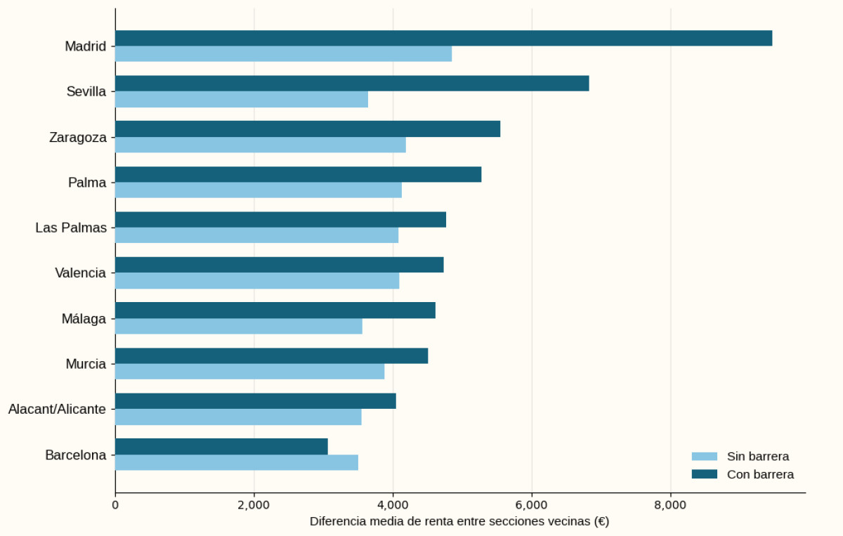
Source: Instituto Nacional de Estadística (Atlas of household income distribution: average income per consumption unit 2023), OpenStreetMap.
With a large gap compared to the rest, highways are the infrastructures that exhibit the greatest income inequality between the areas they separate, doubling the gap that exists between adjacent zones without a barrier —€8,000 versus €4,000, respectively—. This is probably due to their low porosity, since even with pedestrian bridges in between, the surrounding environment they create tends to be degraded.
“Highways are the infrastructures that show the greatest income inequality between the areas they separate”
There was a moment in history, roughly from the mid to late twentieth century, when it was considered that cities should be oriented toward speed, that is, toward cars, which led us to build large inner-city highways. This contributed to generating the ‘connectivity paradox’, as these large transport infrastructures connect areas separated within the city, while at the same time they physically separate nearby areas.
The rest of the infrastructures also show high income inequalities around them, though much more nuanced. The probable cause is that it is much nicer to cross a park or cross a bridge over a river. However, from urban design, it is important to improve connectivity, creating safe pedestrian spaces with environmental quality, and to build a permeable city, with a human scale and prioritizing local movements over long-distance ones.
In the words of Sendra and Sennett, it is necessary to turn borders into edges. Both are borders, but the former hinder social interaction, while the latter generate it.
Income difference per consumption unit by type of infrastructure in the ten most populous municipalities in Spain. 2023
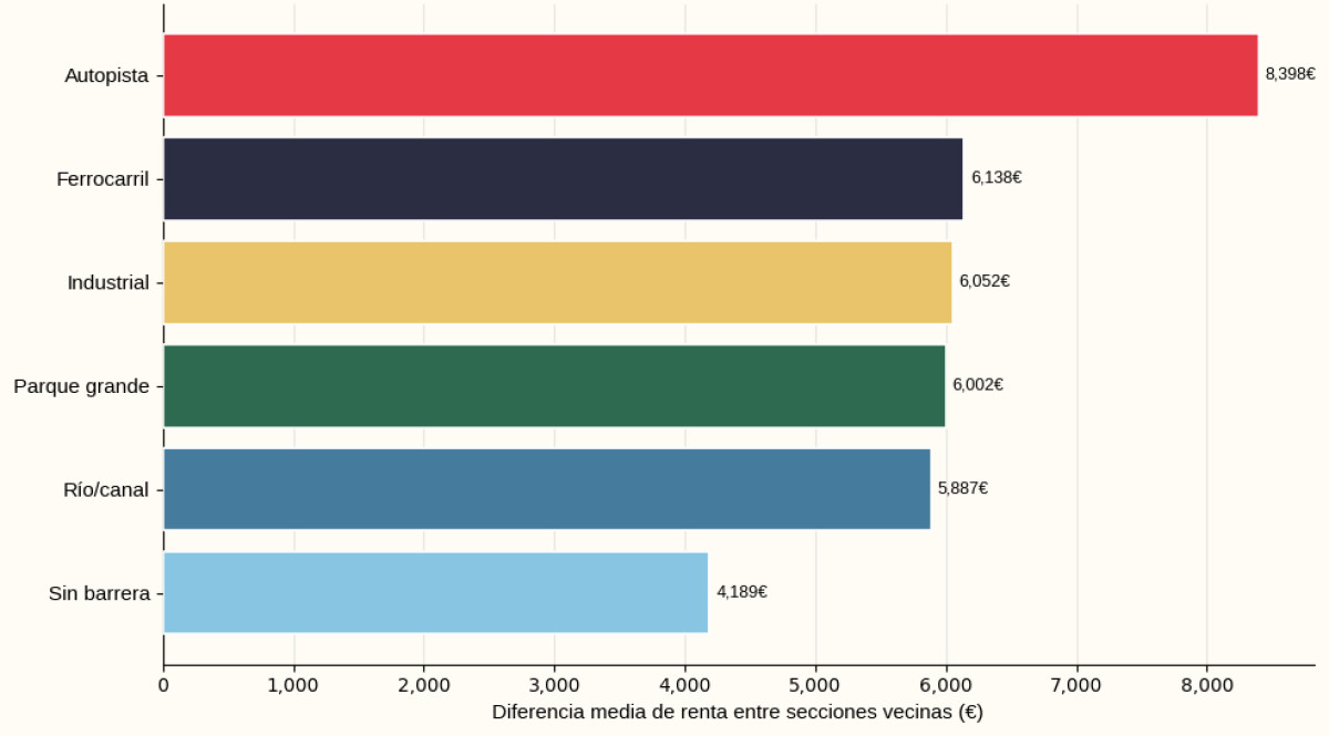
Source: Instituto Nacional de Estadística (Atlas of household income distribution: average income per consumption unit 2023), OpenStreetMap.
The city is a web of social relations laid on a physical support that, when fragmented, breaks the very fabric of social relations. This contributes to crystallizing social inequality over time, hence the trend in urban design should move toward the demolition of borders rather than the construction of new ones.
In collaboration with the “la Caixa” Foundation
